Danger level
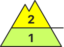
2100m
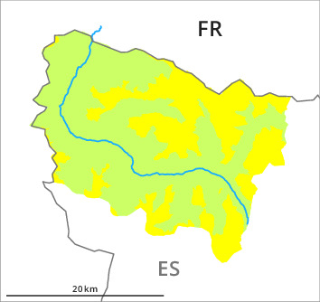
Avalanche Problem

Wind-drifted snow

2100m

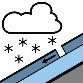
New snow


Wind slabs represent the main danger.
The fresh snow and in particular the mostly small wind slabs can be released by a single winter sport participant on steep east, southeast and south facing slopes. Careful route selection is required.
Snowpack
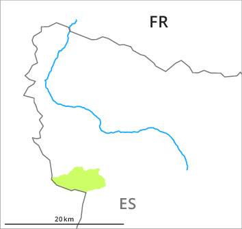
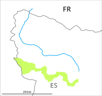
>At the divide with the Ribagorçana basin basin 15 to 25 cm of snow has fallen above approximately 1000 m. Adjacent to ridgelines and in pass areas and on slopes the likelihood of dry avalanches will increase during the day.
Tendency
The avalanche danger will increase significantly during the day.