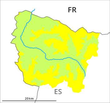
Danger level
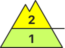
2000m
Avalanche Problem

Wind-drifted snow

2000m

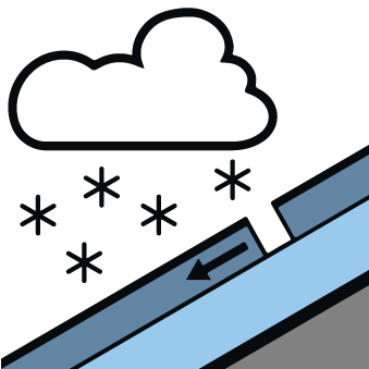
New snow
2000m
Wind slabs represent the main danger. As a consequence of the new snow the avalanche prone locations will become more prevalent as the day progresses.
The mostly small wind slabs of the weekend can be released easily in many cases at intermediate and high altitudes, especially at their margins. They are mostly small but to be assessed with care and prudence. In the regions exposed to heavier precipitation caution is to be exercised in particular adjacent to ridgelines in all aspects and. As a consequence of new snow and wind the prevalence and size of the avalanche prone locations will increase as the day progresses.
Snowpack
>5 to 15 cm of snow, and even more in some localities, has fallen since Saturday above approximately 2000 m. The gusty wind has transported the new snow significantly. The new snow and wind slabs of the weekend are lying on a crust in all aspects. In steep terrain there is a danger of falling on the hard crust. 5 to 10 cm of snow, and even more in some localities, will fall until Tuesday above approximately 2000 m. The sometimes moderate wind will transport the new snow.
At low and intermediate altitudes less snow than usual is lying. At high altitude snow depths vary greatly, depending on the infuence of the wind. At low altitude from a snow sport perspective, insufficient snow is lying.
At low and intermediate altitudes less snow than usual is lying. At high altitude snow depths vary greatly, depending on the infuence of the wind. At low altitude from a snow sport perspective, insufficient snow is lying.
Tendency
Significant increase in avalanche danger as a consequence of new snow and strong wind.