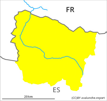
Danger level

2100m
Avalanche Problem

Wind slab

2100m

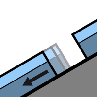
Gliding snow
1500m

Fresh wind slabs represent the main danger.
The fresh wind slabs must be evaluated with care and prudence in particular on steep shady slopes and at intermediate and high altitudes. As a consequence of a sometimes moderate wind from southeasterly directions, small wind slabs formed on Saturday in some localities. As a consequence of new snow and strong wind the wind slabs will increase in size appreciably during the course of the night. These can in many places be released easily, but they will be small in most cases. The avalanche prone locations are to be found in particular in shady places that are protected from the wind and adjacent to ridgelines.
On extremely steep grassy slopes more small gliding avalanches are possible.
On extremely steep grassy slopes more small gliding avalanches are possible.
Snowpack
>
The fresh wind slabs are lying on surface hoar in some places especially on wind-protected shady slopes. Field observations indicate this situation. Some snow will fall until the early morning. The southerly wind will transport the new snow and, in some cases, old snow as well. On Sunday it will be sunny at times. The avalanche prone locations are sometimes covered with new snow and are barely recognisable because of the poor visibility. Off-piste activities call for meticulous route selection.
At intermediate altitudes there are 30 to 50 cm of snow, and even more in some localities. At high altitudes and in high Alpine regions snow depths vary greatly, depending on the infuence of the wind.
At intermediate altitudes there are 30 to 50 cm of snow, and even more in some localities. At high altitudes and in high Alpine regions snow depths vary greatly, depending on the infuence of the wind.
Tendency
Monday: Gradual decrease in danger of dry avalanches as a consequence of warming during the day and solar radiation.