Danger level

Avalanche Problem

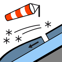
Wind slab


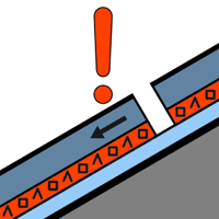
Persistent weak layer

1900m


Wind slabs and weakly bonded old snow require caution. The current avalanche situation calls for defensive route selection.
The new snow of the last five days is lying on soft layers on shady slopes above approximately 1900 m. In many cases the avalanches in these loacations are large and can be released by a single winter sport participant. Transitions from a shallow to a deep snowpack where weaknesses exist in the old snowpack are especially dangerous. Remotely triggered avalanches are possible in isolated cases.
In addition the deep wind slabs of last week on south and east facing slopes are capable of being triggered still. Single winter sport participants can release avalanches, including large ones.
The avalanche prone locations are quite prevalent and are barely recognisable because of the poor visibility.
Snowpack
>
The new snow and wind slabs of last week are lying on the unfavourable surface of an old snowpack especially on little used shady slopes above approximately 1900 m. Released avalanches and distinct weak layers deep in the old snowpack indicate a dangerous avalanche situation. In the last few days on very steep north, east and south facing slopes numerous medium-sized and, in isolated cases, large avalanches were reported.
Up to 80 cm of snow has fallen since Sunday above approximately 1800 m. On Saturday it will be very cloudy.
Above the tree line there are 60 to 90 cm of snow, and even more in some localities. At high altitude snow depths vary greatly, depending on the infuence of the wind.
Up to 80 cm of snow has fallen since Sunday above approximately 1800 m. On Saturday it will be very cloudy.
Above the tree line there are 60 to 90 cm of snow, and even more in some localities. At high altitude snow depths vary greatly, depending on the infuence of the wind.
Tendency
Sunday: 10 to 20 cm of snow will fall until the early morning in all altitude zones. The avalanche danger will not decrease for the time being.