Danger level

Avalanche Problem

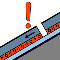
Persistent weak layer


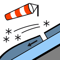
Wind slab


Wind slabs and weakly bonded old snow are to be assessed with care and prudence.
The new snow of last week is lying on the unfavourable surface of an old snowpack on steep, little used shady slopes above approximately 1800 m. In many cases the avalanches in these loacations are large and can be released by a single winter sport participant. Transitions from a shallow to a deep snowpack where weaknesses exist in the old snowpack are especially dangerous. Remotely triggered avalanches are possible in isolated cases.
In addition the deep wind slabs of the last few days on east, south and west facing slopes and generally at high altitudes are easily triggered still. Mostly the avalanches in these loacations are medium-sized and can be released in some cases by a single winter sport participant.
Fresh and somewhat older wind slabs are covered with new snow in some cases and therefore difficult to recognise. Backcountry touring and other off-piste activities call for experience in the assessment of avalanche danger and careful route selection.
Snowpack
>
Over a wide area 5 cm of snow, and even more in some localities, fell in the past few hours in all altitude zones. Up to 90 cm of snow fell in the last seven days above approximately 1800 m. The sometimes strong wind has transported the new snow significantly. The snowpack remains unstable on wind-loaded slopes. Faceted weak layers exist deep in the snowpack in particular on wind-protected shady slopes. Whumpfing sounds and stability tests indicate a very precarious avalanche situation.
Above the tree line there are 50 to 100 cm of snow, and even more in some localities. At intermediate and high altitudes snow depths vary greatly, depending on the infuence of the wind.
Above the tree line there are 50 to 100 cm of snow, and even more in some localities. At intermediate and high altitudes snow depths vary greatly, depending on the infuence of the wind.
Tendency
Wednesday: The danger of dry slab avalanches will persist.