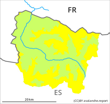
Danger level

2000m
Avalanche Problem

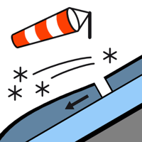
Wind slab

2000m


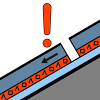
Persistent weak layer

2200m


Wind slabs and weakly bonded old snow represent the main danger.
The small wind slabs of the last two days can be released in isolated cases, but mostly only by large additional loads, on north to east to southeast facing aspects above approximately 2000 m. The avalanche prone locations are to be found adjacent to ridgelines and in pass areas and in gullies and bowls. Dry avalanches can in very isolated cases be released in deeper layers, in particular by large additional loads. These can reach medium size on shady slopes.
Backcountry touring and other off-piste activities call for experience in the assessment of avalanche danger.
Backcountry touring and other off-piste activities call for experience in the assessment of avalanche danger.
Snowpack
>
10 to 15 cm of snow, and even more in some localities, fell in the last three days above approximately 1200 m. As a consequence of the occasionally storm force northwesterly wind, fresh snow drift accumulations formed. 0 to 5 cm of snow will fall until the evening above approximately 1800 m.
The fresh and older wind slabs are lying on the unfavourable surface of an old snowpack on shady slopes above approximately 2200 m.
Above the tree line there are 60 to 90 cm of snow. In particular at high altitude snow depths vary greatly, depending on the infuence of the wind.
The fresh and older wind slabs are lying on the unfavourable surface of an old snowpack on shady slopes above approximately 2200 m.
Above the tree line there are 60 to 90 cm of snow. In particular at high altitude snow depths vary greatly, depending on the infuence of the wind.
Tendency
Monday: Gradual increase in danger of dry avalanches as the snowfall becomes more intense. The avalanche danger will increase during the day, reaching danger level 3 (considerable).