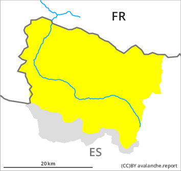
Danger level

2200m
Avalanche Problem

Wind slab

2200m


Wet snow
1900m
Wind slabs and wet snow require caution.
As a consequence of new snow and wind from southerly directions, wind slabs formed in particular adjacent to ridgelines and in pass areas as well as at elevated altitudes. In many cases avalanches are medium-sized and easily released. Large avalanches are further not ruled out.
Especially on steep sunny slopes and at low and intermediate altitudes small and medium-sized moist snow slides and avalanches are to be expected as a consequence of warming during the day and solar radiation. Individual gliding avalanches can also occur.
Backcountry touring calls for experience in the assessment of avalanche danger.
Snowpack
>
In particular high altitudes: At the southern border of Aran up to 30 cm of snow, and even more in some localities, has fallen.
Sunday: The weather will be sunny at times. The wind will be moderate adjacent to ridgelines.
At low altitude no snow is lying.
Sunday: The weather will be sunny at times. The wind will be moderate adjacent to ridgelines.
At low altitude no snow is lying.
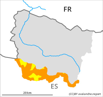
Tendency
Gradual decrease in danger of dry and moist avalanches.