Danger level

2000m
Avalanche Problem

Wet snow

2000m

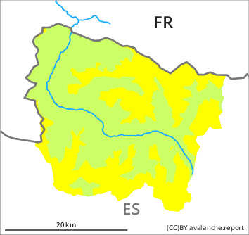
Wet snow represents the main danger. Especially in the valleys bordering the Ribagorçana basin and the Pallaresa basin the avalanche prone locations are more prevalent.
In all aspects mostly small moist snow slides and avalanches are to be expected as a consequence of warming during the day. Avalanches can release the saturated snowpack and reach medium size.
The Avalanche Warning Service currently has only a small amount of information about the snowpack, so that the avalanche danger should be investigated especially thoroughly in the relevant locality.
The Avalanche Warning Service currently has only a small amount of information about the snowpack, so that the avalanche danger should be investigated especially thoroughly in the relevant locality.
Snowpack
>
On Friday it will be sunny. The wind will be moderate to strong adjacent to ridgelines.
The surface of the snowpack will freeze very little and will already soften in the late morning. Sunshine and high temperatures will give rise as the day progresses to rapid moistening of the snowpack. At low altitude no snow is lying.
The surface of the snowpack will freeze very little and will already soften in the late morning. Sunshine and high temperatures will give rise as the day progresses to rapid moistening of the snowpack. At low altitude no snow is lying.
Tendency
Saturday: Significant increase in danger of dry avalanches as a consequence of new snow and wind. Rapid decrease in danger of moist avalanches as the snowfall level drops.