Danger level

treeline
Avalanche Problem

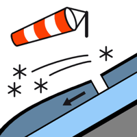
Wind slab

Treeline


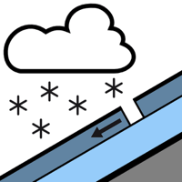
New snow

1500m


The Avalanche Warning Service currently has only a small amount of information. With immediate effect, the avalanche bulletin will appear daily at 5 pm.
New snow and wind slabs as the day progresses.
The more recent wind slabs can be released easily. or in isolated cases naturally, at intermediate and high altitudes. Especially on very steep slopes and in shady places that are protected from the wind dry snow slides are to be expected. The avalanches are rather small.
The older wind slabs can be released in particular on steep shady slopes at high altitude. In particular adjacent to ridgelines these are in some cases medium-sized.
Careful route selection is important. The avalanche prone locations are barely recognisable because of the poor visibility.
The older wind slabs can be released in particular on steep shady slopes at high altitude. In particular adjacent to ridgelines these are in some cases medium-sized.
Careful route selection is important. The avalanche prone locations are barely recognisable because of the poor visibility.
Snowpack
>
Over a wide area 15 to 20 cm of snow fell in the past few hours. 15 cm of snow, and even more in some localities, will fall until the early morning. The wind will be strong to storm force adjacent to ridgelines especially at the southern and eastern borders of Aran.
Shady slopes high altitudes: Towards its base, the snowpack is faceted.
In particular at elevated altitudes snow depths vary greatly, depending on the infuence of the wind.
Shady slopes high altitudes: Towards its base, the snowpack is faceted.
In particular at elevated altitudes snow depths vary greatly, depending on the infuence of the wind.
Tendency
Slight decrease in avalanche danger as the precipitation eases.