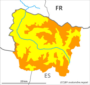
Danger level

2200m
Avalanche Problem

Wind slab

2200m


New snow
2000m

In particular high altitudes: The avalanche conditions remain dangerous.
New snow, wind slabs and old snow are to be assessed with care and prudence.
The cold fresh snow and all the wind slabs must be evaluated with care and prudence in all aspects. This snow is lying on top of a weakly bonded old snowpack in particular on rather lightly snow-covered shady slopes. Fresh and somewhat older wind slabs are sometimes deep and prone to triggering. They are covered with new snow in some cases and therefore difficult to recognise. As a consequence of new snow and a moderate to strong southeasterly wind, further wind slabs will form by Saturday in particular on north and west facing slopes. Sometimes dry avalanches are medium-sized.
The new snow of the last few days can be released naturally in particular on very steep sunny slopes. In the event of solar radiation this applies.
In particular in regions exposed to heavier precipitation the avalanche prone locations are more prevalent and the danger is greater. Ski touring and other off-piste activities, including snowshoe hiking, call for extensive experience in the assessment of avalanche danger and restraint.
Snowpack
>
30 to 40 cm of snow, and even more in some localities, fell in the last few days above approximately 1500 m. Steep sunny slopes: As a consequence of mild temperatures and solar radiation the snowpack settled. Shady slopes intermediate and high altitudes: The new snow and wind slabs are poorly bonded with the old snowpack. Released avalanches and field observations confirm this situation.
Saturday: Some snow will fall until the early morning. In particular adjacent to ridgelines and in pass areas high altitudes: The southeasterly wind will transport the new snow.
At intermediate altitudes there are 50 to 100 cm of snow, and even more in some localities. At elevated altitudes snow depths vary greatly, depending on the infuence of the wind.
Tendency
Sunday: The danger of dry avalanches will decrease gradually. The danger of moist avalanches will increase during the day.