EARLIER
Danger level

Avalanche Problem

Wet snow


Wind slab

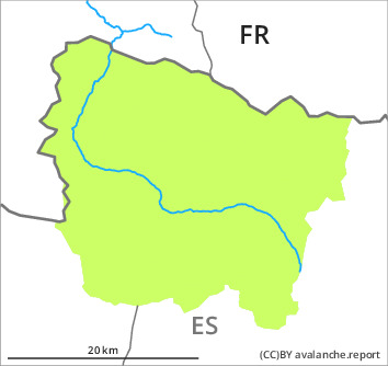
2700m

LATER
Danger level

Avalanche Problem
Wet snow

Wind slab
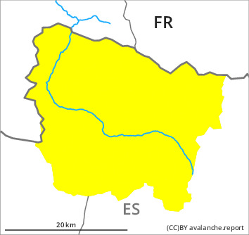
2700m
The Avalanche Warning Service currently has only a small amount of information about the snowpack.
Moist snow slides and avalanches as the day progresses.
Sunny slopes as well as low and intermediate altitudes: As a consequence of warming during the day and solar radiation moist snow slides and avalanches are possible as the day progresses, even medium-sized ones. In addition a latent danger of gliding avalanches exists.
Very steep shady slopes, above approximately 2700 m: The wind slabs can be released in isolated cases.
Backcountry tours should be started and concluded early.
Very steep shady slopes, above approximately 2700 m: The wind slabs can be released in isolated cases.
Backcountry tours should be started and concluded early.
Snowpack
>
Friday: The weather will be mostly sunny. The surface of the snowpack will freeze to form a strong crust and will soften during the day.
Sunny slopes and low and intermediate altitudes: The snowpack will be generally wet all the way through.
At intermediate and high altitudes there is still a very large amount of snow. At high altitude snow depths vary greatly, depending on the infuence of the wind.
Sunny slopes and low and intermediate altitudes: The snowpack will be generally wet all the way through.
At intermediate and high altitudes there is still a very large amount of snow. At high altitude snow depths vary greatly, depending on the infuence of the wind.
Tendency
Saturday: Slight increase in danger of moist avalanches.