EARLIER
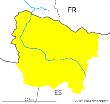
Danger level

Avalanche Problem
Gliding snow


Wet snow
LATER
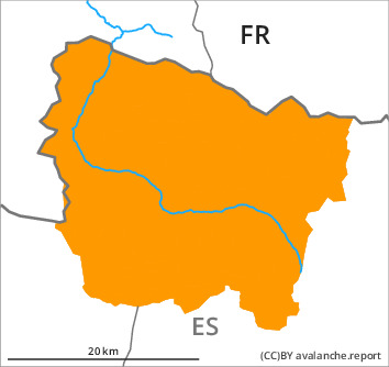
Danger level

Avalanche Problem
Gliding snow
Wet snow
The Avalanche Warning Service currently has only a small amount of information about the snowpack, so that the avalanche danger should be investigated especially thoroughly in the relevant locality.
Gradual increase in danger of wet and gliding avalanches in the course of the day.
All aspects high Alpine regions: Wet snow slides and avalanches are possible as the day progresses, even medium-sized ones. Avalanches can be released by people or triggered naturally. In the afternoon as a consequence of the rain there will be an increase in the danger of moist avalanches.
In addition an acute danger of gliding avalanches exists. Sometimes they are large.
Backcountry tours should be started and concluded very early. Areas with glide cracks are to be avoided.
In addition an acute danger of gliding avalanches exists. Sometimes they are large.
Backcountry tours should be started and concluded very early. Areas with glide cracks are to be avoided.
Snowpack
>
Outgoing longwave radiation during the night will be reduced. The surface of the snowpack will only just freeze and will already soften in the late morning. In the early morning the weather will be mostly sunny. Up to 2800 m rain will fall in the afternoon in some regions.
The snowpack will be generally wet all the way through. Steep west, north and east facing slopes intermediate and high altitudes: Several medium-sized and large gliding avalanches have been released in the last few days.
Over a wide area a lot of snow is lying for the time of year.
The snowpack will be generally wet all the way through. Steep west, north and east facing slopes intermediate and high altitudes: Several medium-sized and large gliding avalanches have been released in the last few days.
Over a wide area a lot of snow is lying for the time of year.
Tendency
Tuesday: The conditions remain spring-like.