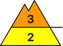
Danger level
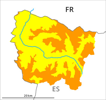
2000m
Avalanche Problem

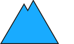
Wind-drifted snow

2000m

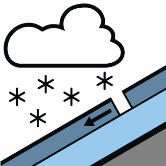
New snow

New snow and wind slabs as the day progresses.
Wind and new snow above approximately 1500 m: In particular at intermediate and high altitudes the wind slabs will increase in size substantially as the day progresses. The fresh wind slabs are in some cases extensive and can be released easily. The avalanche prone locations are to be found in particular adjacent to ridgelines and in gullies and bowls above approximately 2000 m. In isolated cases the avalanches can be released in the various wind slab layers and reach large size in some cases. In steep rocky terrain natural dry avalanches are to be expected as the day progresses, even medium-sized ones. The danger will increase during the day, reaching danger level 3 (considerable).
As the temperature drops hardly any more gliding avalanches and moist snow slides are possible.
As the temperature drops hardly any more gliding avalanches and moist snow slides are possible.
Snowpack
>70 to 90 cm of snow, and even more in some localities, has fallen since Friday above approximately 1800 m. Adjacent to ridgelines in all aspects as well as at high altitudes and in high Alpine regions snow depths vary greatly, depending on the infuence of the wind. The new snow is lying on soft layers on shady slopes at high altitude. The rain gave rise as the day progresses to significant moistening of the snowpack in all aspects below approximately 2100 m. 30 to 40 cm of snow, and even more in some localities, will fall in the next few hours above approximately 1500 m.
Backcountry touring calls for experience in the assessment of avalanche danger and restraint.
Backcountry touring calls for experience in the assessment of avalanche danger and restraint.
Tendency
Significant increase in avalanche danger as a consequence of warming during the day and solar radiation.