Danger level
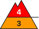
2000m
Avalanche Problem
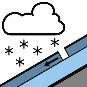
New snow

2000m


Wet snow

2200m
New snow and wind slabs are to be critically assessed.
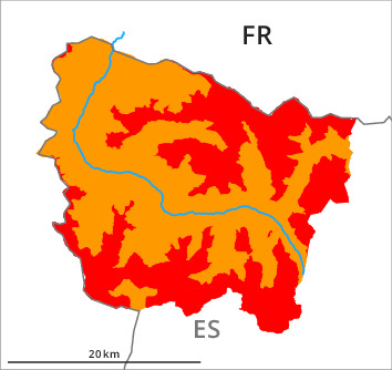
The new snow and wind slabs can be released easily or naturally in all aspects above approximately 2000 m. In addition moist and wet avalanches are to be expected.
As a consequence of new snow and strong wind natural dry avalanches are to be expected as the day progresses, in particular medium-sized ones. These can in many places be released by small loads. In particular on the peaks and ridges of the divide with the Ribagorçana basin and the Pallaresa basin sometimes large wind slabs will form. The number and size of avalanche prone locations will increase as the day progresses.
Snowpack
>Over a wide area 40 cm of snow, and even more in some localities, has fallen since Saturday above approximately 2000 m. 10 to 15 cm of snow, and even more in some localities, will fall until the evening above approximately 1500 m. The wind will be strong adjacent to ridgelines in particular at the southern and eastern borders of Aran.
Over a wide area new snow and wind slabs are lying on a hard crust. The covering of new snow is unfavourably layered.
The conditions are very dangerous for backcountry touring outside marked and open pistes. The current avalanche situation calls for great restraint.
Over a wide area new snow and wind slabs are lying on a hard crust. The covering of new snow is unfavourably layered.
The conditions are very dangerous for backcountry touring outside marked and open pistes. The current avalanche situation calls for great restraint.
Tendency
Gradual decrease in avalanche danger as a consequence of the ceasing of precipitation.