Danger level
2300m
Avalanche Problem

Wind-drifted snow

2300m


Wet snow
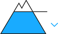
2300m

Fresh wind slabs at high altitudes and in high Alpine regions. Gliding avalanches and moist snow slides until the middle of the day.
As a consequence of new snow and a moderate to strong southerly wind, sometimes avalanche prone wind slabs will form in the course of the day in particular adjacent to ridgelines on north and east facing slopes. Mostly Explanation: "these" may only stand for "these avalanches" are small and can be released easily by a single winter sport participant. Until the temperature falls more small and, in isolated cases, medium-sized gliding avalanches and moist snow slides are possible below approximately 2300 m.
Snowpack
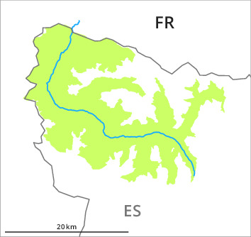
>In particular at the southern and eastern borders of Aran 15 cm of snow, and even more in some localities, will fall in the next few hours above approximately 2000 m. The southerly wind will transport the new snow significantly. The upper section of the snowpack is moist. As a consequence of sleet the snowpack can not consolidate by the middle of the day.
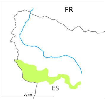
At low and intermediate altitudes less snow than usual is lying. At high altitude snow depths vary greatly, depending on the infuence of the wind. At low altitude from a snow sport perspective, insufficient snow is lying.
At low and intermediate altitudes less snow than usual is lying. At high altitude snow depths vary greatly, depending on the infuence of the wind. At low altitude from a snow sport perspective, insufficient snow is lying.
Tendency
Significant increase in danger of dry avalanches as a consequence of new snow and wind. Rapid decrease in danger of moist avalanches as the temperature drops.